Assessed value
$303,300
$246,500 bldg · $56,800 land
Est. annual tax
$6,849
22.58 mills · FY2026
Acreage
2.43 ac
$124,815 / ac
Land use
101
Year built
2002
2,059 sqft
Owner mailing
Bethlehem, CT
Building
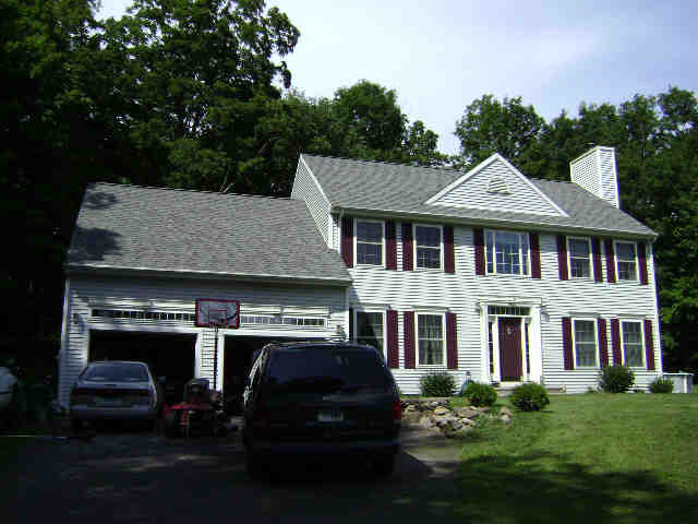
- Style
- Colonial
- Year built
- 2002
- Living area
- 2,059 sqft · 2.0 stories
- Exterior
- Vinyl Siding
Recorded sales
No recorded sales on file.
More on Sanford Ln
10 SANFORD LN
$428,500 · 1 ac · Built 1959
15 SANFORD LN
$257,800 · 0.98 ac · Built 1966
19 SANFORD LN
$182,800 · 1.21 ac · Built 1963
21 SANFORD LN
$224,500 · 2 ac · Built 1959
25 SANFORD LN
$165,200 · 0.5 ac · Built 1955
32 SANFORD LN
$194,500 · 0.75 ac · Built 1969
33 SANFORD LN
$342,400 · 1 ac · Built 1956
39 SANFORD LN
$185,100 · 0.73 ac · Built 1976