Assessed value
$1,275,070
$661,400 bldg · $613,670 land
Acreage
143.58 ac
$8,881 / ac
Land use
1-1
RR1/RR3
Year built
1843
3,228 sqft
Owner mailing
Salisbury, CT
Different from property address (absentee owner)
Building
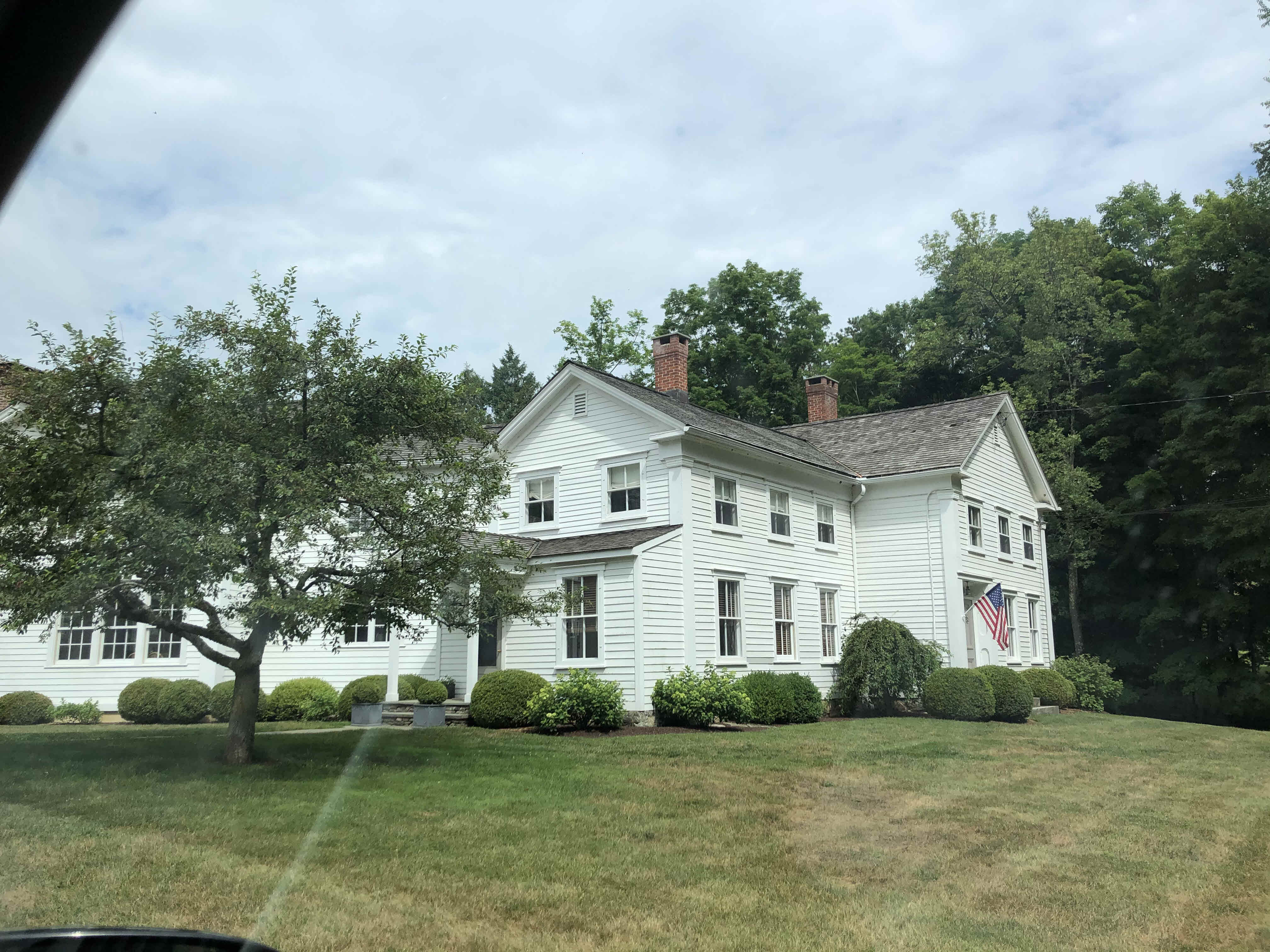
- Style
- Antique
- Year built
- 1843
- Living area
- 3,228 sqft · 2.0 stories
- Exterior
- clapboard
Site characteristics
- Wetlands
- 2% of parcel area
- Protected open space
- UnknownPrivate
Recorded sales
Apr 12, 2019
— MCGRATH ANNE
Bk/Pg 0256/0584
Mar 16, 1995
— MCGRATH WILLIAM KEVIN + ANNE
Bk/Pg 0160/1014
Apr 1, 1985
— HERNDON JOHN J.C.
Bk/Pg 0133/0066
Planning & Zoning actions
More on Housatonic River Road
3 HOUSATONIC RIVER ROAD
$294,400 · 2.89 ac · Built 2005
24 HOUSATONIC RIVER ROAD
$389,600 · 2.26 ac · Built 1950
112+138 HOUSATONIC RIVER ROAD
$3,826,130 · 222.4 ac · Built 1740
115 HOUSATONIC RIVER ROAD
$4,058,830 · 167.58 ac · Built 1880
127 HOUSATONIC RIVER ROAD
$200,200 · 2.23 ac
194 HOUSATONIC RIVER ROAD
$587,400 · 1.83 ac · Built 1980
200 HOUSATONIC RIVER ROAD
$500,300 · 2.48 ac · Built 1973
230 HOUSATONIC RIVER ROAD
$862,300 · 16.81 ac · Built 2009